


WEST POINT 1, White County, Indiana
About
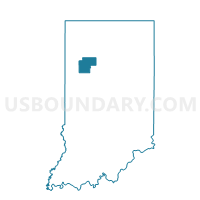
Outline

Summary
| Unique Area Identifier | 581274 |
| Name | WEST POINT 1 |
| County | White County |
| State | Indiana |
| Area (square miles) | 53.60 |
| Land Area (square miles) | 53.53 |
| Water Area (square miles) | 0.07 |
| % of Land Area | 99.87 |
| % of Water Area | 0.13 |
| Latitude of the Internal Point | 40.69979330 |
| Longtitude of the Internal Point | -87.01447360 |
Maps


Graphs
Select a template below for downloading or customizing gragh for WEST POINT 1, White County, Indiana


Neighbors
Neighoring Voting District (by Name) Neighboring Voting District on the Map
- BIG CREEK 1, White County, IN
- GILBOA, Benton County, IN
- HONEY CREEK 1, White County, IN
- PINE, Benton County, IN
- PRAIRIE 1, White County, IN
- PRINCETON 1, White County, IN
- PRINCETON 2, White County, IN
- ROUND GROVE 1, White County, IN
Top 10 Neighboring County Subdivision (by Population) Neighboring County Subdivision on the Map
- Prairie township, White County, IN (3,180)
- Princeton township, White County, IN (1,553)
- Honey Creek township, White County, IN (1,162)
- Big Creek township, White County, IN (819)
- West Point township, White County, IN (381)
- Pine township, Benton County, IN (330)
- Round Grove township, White County, IN (259)
- Gilboa township, Benton County, IN (250)
Top 10 Neighboring Unified School District (by Population) Neighboring Unified School District on the Map
- Benton Community School Corporation, IN (11,050)
- North White School Corporation, IN (6,077)
- Tri-County School Corporation, IN (4,294)
- Frontier School Corporation, IN (4,101)
Top 10 Neighboring State Legislative District Lower Chamber (by Population) Neighboring State Legislative District Lower Chamber on the Map
Top 10 Neighboring State Legislative District Upper Chamber (by Population) Neighboring State Legislative District Upper Chamber on the Map
Top 10 Neighboring 111th Congressional District (by Population) Neighboring 111th Congressional District on the Map
Top 10 Neighboring Census Tract (by Population) Neighboring Census Tract on the Map
- Census Tract 1001, Benton County, IN (3,413)
- Census Tract 9588, White County, IN (3,185)
- Census Tract 9583, White County, IN (2,405)
- Census Tract 9584, White County, IN (2,300)